
Walking a wooded property tells you some things. You can feel the slope under your feet, spot a creek running through the middle, and get a rough sense of how dense the trees are. But walking a property doesn’t tell you enough to spend serious money on engineering and design. Trees block the view. Thick brush hides low spots. A ridge that looks minor on foot might be a real problem for a road alignment. LiDAR mapping changes what developers can know about a property before they commit to anything, and that’s making a difference in how wooded tracts get evaluated.
Looking Past the Tree Canopy Before Money Gets Committed to a Project
Early project decisions carry a lot of weight. The layout of streets, the placement of lots, the location of drainage, all of it flows from the first read of the land. If that first read is based on a rough site visit and a basic aerial photo, there’s a good chance the team is missing things that matter.
LiDAR mapping sends laser pulses through the tree canopy and picks up the ground surface underneath. The result is a detailed picture of the land itself, not just the tops of the trees sitting on it. Developers get that picture before engineers start drawing anything, which means the early decisions are based on real ground data instead of guesses. That’s a different starting point than most wooded tract evaluations used to have, and it changes what teams feel confident committing to before the big spending begins.
Why Some Wooded Properties Reveal More Buildable Area Than Expected
Dense woods have a way of hiding what’s inside them. A property that looks like a steep, tangled mess from the road or from an aerial image might have flat, workable sections sitting in the middle of it. Buyers and developers pass on properties like that all the time because the canopy makes the land look worse than it actually is.
LiDAR mapping strips that canopy away, at least visually. The ground data it produces shows where the flat areas are, where slopes are manageable, and where the terrain actually allows for building. Some wooded tracts turn out to have more usable land than anyone expected once the tree cover is removed from the picture. That information can change how a developer prices a property, how they approach a seller, and whether a tract that looked marginal at first glance is actually worth pursuing. Getting that clarity before a purchase decision is made is a big deal.
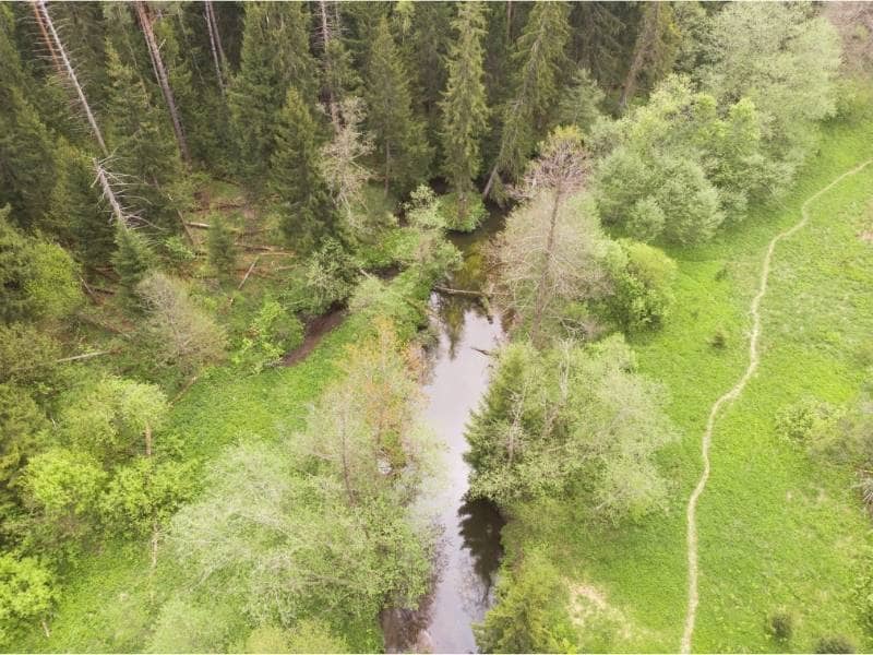
Evaluating Natural Features Before Streets and Lots Are Drawn
No good development plan ignores the land it sits on. Ridges, low areas, drainage corridors, and natural land patterns all affect where streets can go, where lots make sense, and where water needs to be managed. The problem is that on a heavily wooded tract, those features are hard to see until someone clears the land, which is exactly the kind of commitment developers want to avoid making before they understand what they’re working with.
LiDAR mapping gives teams a detailed look at those natural features without touching a single tree. Designers can see where water naturally flows across the site, where high points and low points sit, and how the terrain shapes the way a layout might work. That information feeds directly into early planning conversations. Instead of drawing a street grid and then discovering it crosses a drainage corridor that shouldn’t be disturbed, the team knows about that corridor from the start and designs around it. That’s a much easier conversation to have at the beginning than after engineering work is already underway.
How LiDAR Mapping Helps Compare Multiple Tracts During Site Selection
Developers and investors rarely look at just one property at a time. Site selection usually involves comparing several tracts, weighing the pros and cons of each, and trying to figure out which one gives the project the best chance of working. That comparison is hard to do well when the information about each property comes from different sources with different levels of detail.
LiDAR mapping produces consistent data across different properties. When two or three tracts get mapped the same way, the comparison becomes more reliable. The team can look at slope distributions, drainage patterns, and usable areas side by side without trying to reconcile information gathered through different methods. Here’s what that consistent data helps developers compare across multiple sites:
- How much of each tract has slopes that work for residential grading
- Where natural drainage corridors sit and how they affect usable land
- Whether access points align with existing roads in ways that keep infrastructure costs manageable
- How the overall shape and terrain of each property supports the intended layout
That kind of comparison gives site selection a more solid foundation than a side-by-side look at aerial photos ever could.
Why Early Land Intelligence Can Reduce Redesign Later in the Project
Redesign is expensive. When a project gets deep into engineering and then hits a problem that changes the layout, the work that already got done may need to be redone. Street alignments shift. Lot counts drop. Drainage solutions that made sense in the original layout stop working in the revised one. Every change that happens after engineering is underway costs more than it would have cost to get the information right at the start.
LiDAR mapping is one of the ways developers reduce that risk. When the team has detailed ground data before design begins, the layout that gets drawn is already working with the land rather than against it. Problems that would have surfaced midway through engineering show up in the early planning stage instead, where they’re cheaper and faster to deal with. That’s not just a technical benefit. It’s a financial one, and it’s one of the main reasons LiDAR mapping on wooded tracts has gone from a specialty tool to a standard part of how serious development teams start a project.
Frequently Asked Questions
What is LiDAR mapping used for on wooded properties?
It collects detailed information about the ground surface and natural features of a property, even when heavy tree cover makes the land hard to see and assess through other methods.
Why do developers use LiDAR mapping before designing a project?
It gives the design team a clear picture of the land before streets, lots, and infrastructure get planned. That means fewer surprises once engineering work begins.
Can LiDAR mapping help evaluate multiple sites?
Yes. It produces consistent ground data across different properties, which makes side-by-side comparisons more reliable during site selection.
Is LiDAR mapping useful before buying land?
Yes. Many developers and landowners use it to get a realistic read on a tract before making long-term commitments or significant financial decisions.
Who commonly requests LiDAR mapping services?
Developers, engineers, investors, builders, and landowners use it during the early stages of planning, especially on properties where the terrain is difficult to assess through standard methods.